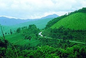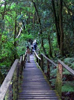
Doi Inthanon National Park covers the areas of Sanpatong District, Chomthong District, Mae Chaem District, Mae Wang District, and Toi Lor Sub-district of Chiang Mai Province within an approximate area of 482 square kilometers. The National Park consists of high mountains, including Doi Inthanon, which is the highest mountaintop in Thailand and the source of many rivers such as Ping River, where the Bhumipol Dam is situated and generating the electrical power. The National Park has beautiful natural scenery such as waterfalls, particularly Mae Ya Waterfall, which is one of the most beautiful waterfalls in Thailand.

Since the National Park is located at 2,565 meters above the sea level, it has cold weather and high humidity throughout the year, particularly on the top of the National Park. In winter, the temperature at the National Park is below 0ac. And in summer, despite hot weather in central Chiang Mai and nearby districts, it is still freezing on the top of Doi Inthanon and tourists should be prepared with thick clothes.

Because of its broad altitudinal range and the cool climate of its upper reaches, the park supports the largest number of bird species of any site in Thailand. The Center for Wildlife Research at Mahidol University records a present total of 362 species and expects addition many at the summit are migrants from northern Asia. Species restricted to Doi Inthanon are Ashy-throated Warbler and an endemic race of the Green-tailed Sunbird; the park is the only site where the Chestnut-bellied Rock-Thrush and the Yellow-bellied Flower pecker are known to over summer and probably breed.
 Doi Inthanon National Park covers the areas of Sanpatong District, Chomthong District, Mae Chaem District, Mae Wang District, and Toi Lor Sub-district of Chiang Mai Province within an approximate area of 482 square kilometers. The National Park consists of high mountains, including Doi Inthanon, which is the highest mountaintop in Thailand and the source of many rivers such as Ping River, where the Bhumipol Dam is situated and generating the electrical power. The National Park has beautiful natural scenery such as waterfalls, particularly Mae Ya Waterfall, which is one of the most beautiful waterfalls in Thailand.
 Since the National Park is located at 2,565 meters above the sea level, it has cold weather and high humidity throughout the year, particularly on the top of the National Park. In winter, the temperature at the National Park is below 0ac. And in summer, despite hot weather in central Chiang Mai and nearby districts, it is still freezing on the top of Doi Inthanon and tourists should be prepared with thick clothes.
 Because of its broad altitudinal range and the cool climate of its upper reaches, the park supports the largest number of bird species of any site in Thailand. The Center for Wildlife Research at Mahidol University records a present total of 362 species and expects addition many at the summit are migrants from northern Asia. Species restricted to Doi Inthanon are Ashy-throated Warbler and an endemic race of the Green-tailed Sunbird; the park is the only site where the Chestnut-bellied Rock-Thrush and the Yellow-bellied Flower pecker are known to over summer and probably breed.


0 Comments:
Post a Comment
<< Home